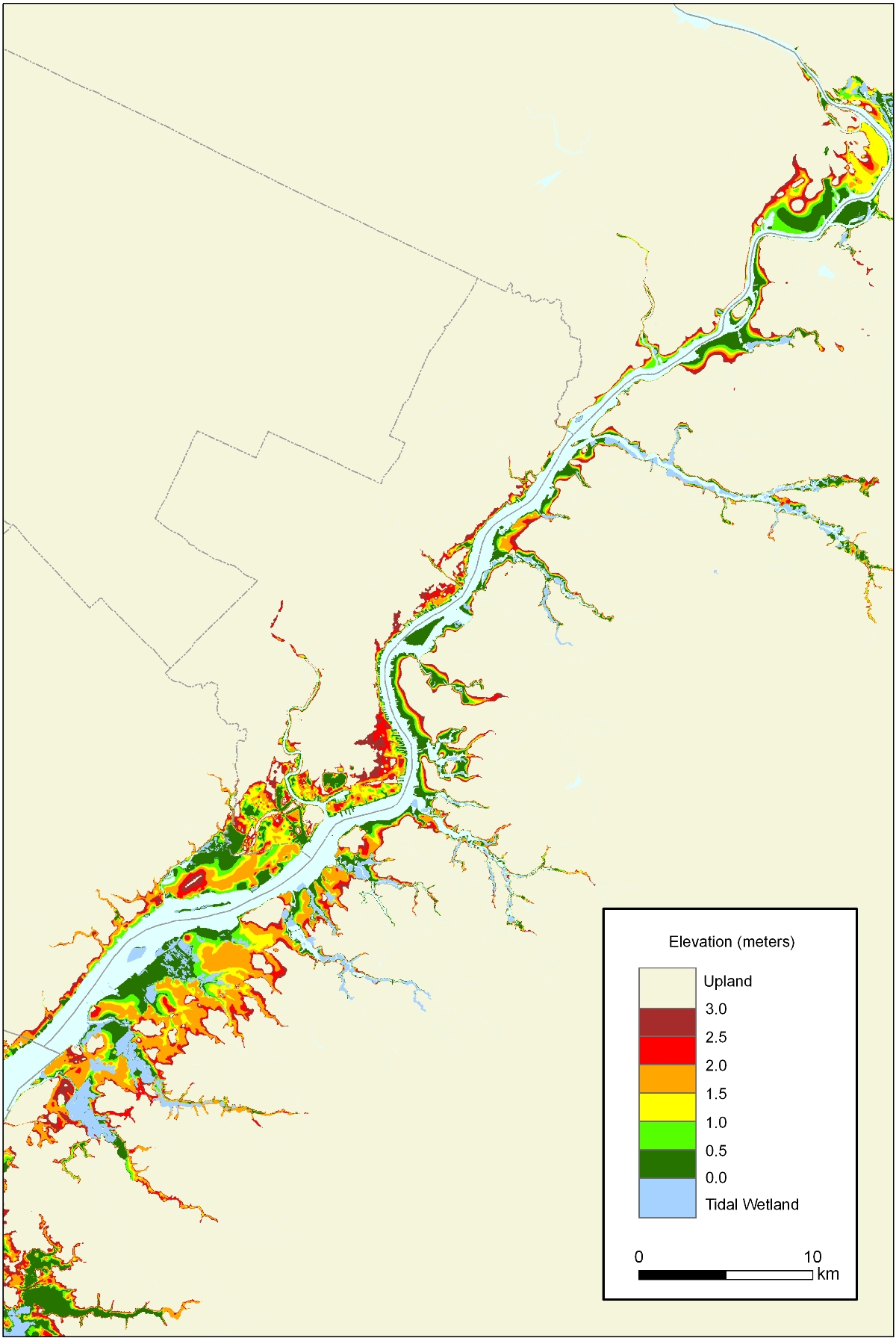
Maps of Lands Close to Sea Level: Pennsylvania
50-centimeter contour interval*
Download print quality version of the Pennsylvania with 50-cm contour interval.
<*>A considerable amount of the land shown below 50 cm is actually below spring high water, as a result of the long history of dikes and tide gates along the Delaware River. Our map of Philadelphia where the purple represents land (other than tidal wetlands) below spring high water

